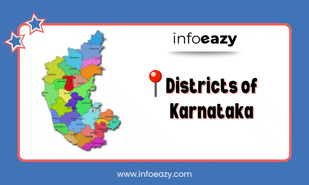
Karnataka, a prominent state located in the southern part of India, is known for its rich cultural heritage, linguistic diversity, and economic significance. The administrative structure of the state is divided into multiple districts, each with unique historical, geographical, and cultural features. Understanding the districts of Karnataka is essential for academic, administrative, and competitive exam purposes.
Districts of Karnataka Overview
Karnataka was formed on 1st November 1956 under the States Reorganisation Act and was initially named Mysore. Later in 1973, it was renamed Karnataka. The state is administratively divided into 31 districts, which are further grouped into four divisions: Bengaluru, Mysuru, Belagavi, and Kalaburagi. Each district is headed by a District Collector and has its own administrative headquarters.
These Districts of Karnataka are important in facilitating governance, implementing government schemes, maintaining law and order, and ensuring regional development. Every district has its own unique identity influenced by language, art, history, and geography.
List of Districts of Karnataka
As of 2025, Karnataka has 31 districts, which are further sub-divided into taluks, hoblis, and gram panchayats. The List of Districts of Karnataka are grouped under the following four administrative divisions:
| List of Districts of Karnataka | |||
| S.No | District Name | Area (km²) | Population |
| 1 | Bagalkot | 6589 | 1,890,748 |
| 2 | Ballari (Bellary) | 11,414 | 2,400,600 |
| 3 | Belagavi (Belgaum) | 15,057 | 4,849,666 |
| 4 | Bengaluru (Bangalore) Rural | 5,002 | 9,877,574 |
| 5 | Bengaluru (Bangalore) Urban | 2,190 | 12,769,151 |
| 6 | Bidar | 5,448 | 1,703,941 |
| 7 | Chamarajanagara | 5,102 | 1,021,017 |
| 8 | Chikballapur | 4,204 | 1,209,908 |
| 9 | Chikkamagaluru (Chikmagalur) | 9,900 | 1,698,749 |
| 10 | Chitradurga | 10,607 | 1,660,267 |
| 11 | Dakshina Kannada | 11,891 | 4,884,256 |
| 12 | Davangere | 5,719 | 1,946,275 |
| 13 | Dharwad | 4,900 | 1,847,533 |
| 14 | Gadag | 6,574 | 1,065,215 |
| 15 | Hassan | 6,811 | 1,772,036 |
| 16 | Haveri | 4,922 | 1,537,449 |
| 17 | Kalaburagi | 10,954 | 25,66,326 |
| 18 | Kodagu | 4,102 | 555,985 |
| 19 | Koppal | 5,417 | 1,391,445 |
| 20 | Kolar | 4,012 | 5,381,991 |
| 21 | Mandya | 4,961 | 1,800,557 |
| 22 | Mysuru (Headquarters) | 6,852 | 1,139,251 |
| 23 | Raichur | 10,402 | 1,945,236 |
| 24 | Ramanagara | 3,287 | 1,073,634 |
| 25 | Shivamogga | 8,495 | 2,719,321 |
| 26 | Tumakuru | 5,619 | 1,098,605 |
| 27 | Udupi | 3,877 | 1,177,908 |
| 28 | Uttar Kannada ( Uttara Kannada) | 10,297 | 1,352,024 |
| 29 | Vijayapura | 10,517 | 2,170,263 |
| 30 | Yadagiri | 5,160 | 1,779,078 |
| 31 | Vijayanagara | 5,815 | 1,209,114 |
Largest District of Karnataka
The Largest District of Karnataka by area is Belagavi (Belgaum) which is approximately 13,415 square kilometers. Situated in northwestern Karnataka, it shares borders with Maharashtra and Goa. Known for its industrial development, agriculture, and educational institutions. It also holds strategic importance due to the long-standing Karnataka-Maharashtra border dispute. Belagavi is not only the largest in area but also one of the most politically significant and economically dynamic districts in the state.
Smallest District of Karnataka
The Smallest District of Karnataka by area is Bengaluru Urban which is approximately 2,196 square kilometers, Centrally located in the southeastern part of Karnataka. Despite its small size, Bengaluru Urban is the most populated, industrialized, and economically important district. It houses the capital city Bengaluru, also known as the “Silicon Valley of India.”
Bengaluru Urban is a global IT hub and contributes significantly to Karnataka’s GDP through services, real estate, education, and startups.
Districts of Karnataka Map
A Districts of Karnataka Map visually presents the geographic distribution of all 31 districts across the state.
Districts of Karnataka FAQs
Q1. How many districts are there in Karnataka in 2025?+
Q2. Which is the largest district in Karnataka?+
Q3. Which is the smallest district in Karnataka?+
Q4. What are the 4 divisions of Karnataka?+
Q5. Which district is famous for IT industries?+
Tags: Districts of Karnataka


