Kerala is located on the southwestern coast of India, is well-known for its lush greenery, literacy rate, backwaters, spices, and cultural diversity. Administratively, the state is divided into districts, each of Kerala plays a crucial role in the smooth functioning of governance, implementation of welfare schemes, and regional development. The Districts of Kerala reflect the socio-cultural vibrancy and geographical uniqueness of the state.
Districts of Kerala About
Kerala was formed on 1st November 1956 following the States Reorganisation Act, bringing together regions where Malayalam is predominantly spoken. The state is divided into 14 Districts of Kerala, each with its own distinct identity in terms of language accents, customs, economic activities, and ecological features.
These districts are grouped under three administrative zones for better governance:
- North Kerala (Malabar region)
- Central Kerala (Cochin region)
- South Kerala (Travancore region)
Each district is headed by a District Collector, who manages law and order, revenue collection, disaster management, and the coordination of development schemes.
List of Districts of Kerala
Each of the Districts of Kerala is subdivided into taluks, blocks, panchayats, and municipalities to ensure decentralization and participative governance. Kerala is known for its efficient Panchayati Raj system, which operates effectively at the grassroots level. The table below includes the List of Districts of Kerala:
| List of Districts of Kerala | |||
| S.No | District Name | Area | Population |
| 1 | Ernakulum | 3427659 | 2924 |
| 2 | Kannur | ||
| 3 | Kollam | ||
| 4 | Kozhikode | ||
| 5 | Palakkad | ||
| 6 | Wayanad | ||
| 7 | Alappuzha | 1415 | 2146033 |
| 8 | Idukki | 4612 | 1093156 |
| 9 | Kasaragod | 1989 | 1390894 |
| 10 | Kottayam | 2206 | 1,983,573 |
| 11 | Malappuram | 3554 | 4,494,998 |
| 12 | Pathanamthitta | 2652 | 1,172,212 |
| 13 | Thiruvananthapuram | 2189 | 3,355,148 |
| 14 | Thrissur | 3027 | 3,243,170 |
Largest District of Kerala
The Largest District of Kerala by area is Palakkad, approximately 4,482 square kilometers which is located in the central part of the state, bordering Tamil Nadu. It is known as the “Gateway of Kerala” due to the Palakkad Gap in the Western Ghats. It is famous for its granaries, dams (like Malampuzha), and paddy fields. Palakkad is agriculturally rich and plays a key role in the state’s food production and energy generation.
Smallest District of Kerala
The Smallest District of Kerala by area is Alappuzha, around 1,415 square kilometers, located in the Coastal region in central Kerala. It is known as the “Venice of the East” due to its extensive network of backwaters, canals, and houseboats. Alappuzha is a top tourist destination and a major contributor to Kerala’s coir and tourism industries. Despite being small in size, Alappuzha has a dense population and is a hub for festivals like Nehru Trophy Boat Race.
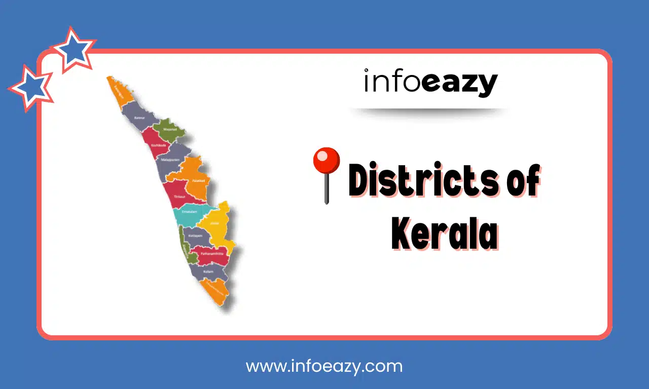
Districts of Kerala Map
A Districts of Kerala Map is an essential tool for understanding the geographical layout, administrative boundaries, and regional characteristics of the state. The map helps in visualizing location, border-sharing states (like Karnataka and Tamil Nadu), and coastal vs. high-range districts.
Districts of Kerala FAQs
Q1. How many districts are there in Kerala in 2025?+
Q2. Which is the largest district in Kerala by area?+
Q3. Which is the smallest district in Kerala by area?+
Q4. Which district is known as the capital of Kerala?+
Q5. Which district is famous for the backwaters and houseboats?+
Tags: Districts of Kerala