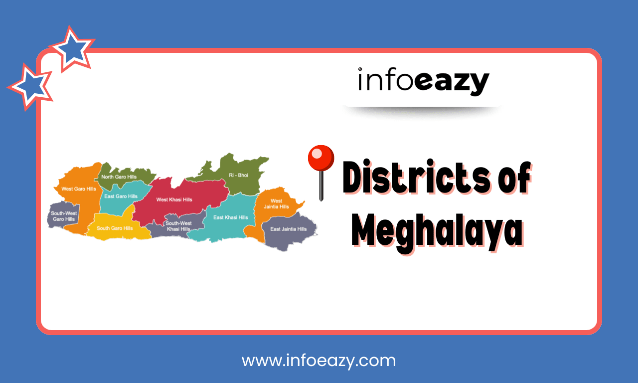
Meghalaya, literally meaning “Abode of Clouds”, is a hilly state in northeastern India, carved out of Assam on 21 January 1972. Administratively, there are 12 Districts of Meghalaya, organized under three major cultural regions, Garo Hills, Khasi Hills, and Jaintia Hills, and further subdivided into blocks and subdivisions, administered by Deputy Commissioners. The state covers an area of 22,429 km² and had a population of approximately 2.97 million as per the Census 2011, characterized by high literacy and significant tribal cultural diversity.
Districts of Meghalaya
Meghalaya is known for its landscapes, high rainfall, and rich biodiversity. Officially formed on 21 January 1972, Meghalaya was carved out of Assam, becoming a separate state to preserve its distinct cultural and ethnic identity. The state is administratively divided into 12 districts, which are further grouped into three major divisions: East, West, and Central Meghalaya. These divisions help manage governance and development more efficiently across the varied terrains and communities of the region.
List of Districts of Meghalaya
The 12 Districts of Meghalaya are categorized into three regional clusters. These divisions reflect distinct cultural and administrative zones, each overseen by its district headquarters and deputy officials.
| List of Districts of Meghalaya | |||
| S.no | District | Area (sq. km) | Population (2011) |
| 1 | East Garo Hills | 2,603 | 825,922 |
| 2 | South Garo Hills | 1,850 | 252,010 |
| 3 | North Garo Hills | 1,113 | 258,840 |
| 4 | West Garo Hills | 2,855 | 110,152 |
| 5 | South West Garo Hills | 822 | 131,451 |
| 6 | Eastern West Khasi Hills | N/A | N/A |
| 7 | Ri Bhoi | 2,378 | 122,939 |
| 8 | West Khasi Hills | 5,247 | 118,325 |
| 9 | East Jaintia Hills | 2,040 | 199,592 |
| 10 | South West Khasi Hills | 1,341 | 142,334 |
| 11 | Jaintia Hills | 1,693 | 472,497 |
| 12 | West Jaintia Hills | 1,693 | 172,495 |
Largest District of Meghalaya
The Largest District of Meghalaya is West Khasi Hills, spanning approximately 5,247 km². The most populous is East Khasi Hills, with around 825,922 residents, centered on the capital, Shillong. These districts are central to the state’s administrative, educational, and economic activity.
Smallest District of Meghalaya
The Smallest District of Meghalaya is South West Garo Hills, covering just 822 km². It’s also the least populous, with approximately 110,152 residents (2011).
Districts of Meghalaya Map
The Districts of Meghalaya Map includes detailed administrative maps that include the boundaries and regional distribution. These visuals are essential for understanding patterns in state planning, disaster management, and cultural geography.
Districts of Meghalaya FAQs
Q1. How many districts are there in Meghalaya?+
Q2. Which district is the largest in area?+
Q3. Which district is the smallest by area?+
Q4. Which district has the highest population?+
Q5. Which district has the least population?+
Tags: Districts of Meghalaya